DID YOU KNOW THE ST. MARY’S SAND SPIT IS PARTLY IN FAIRFIELD?
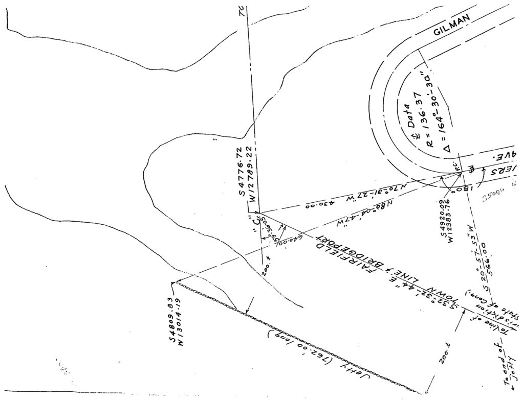
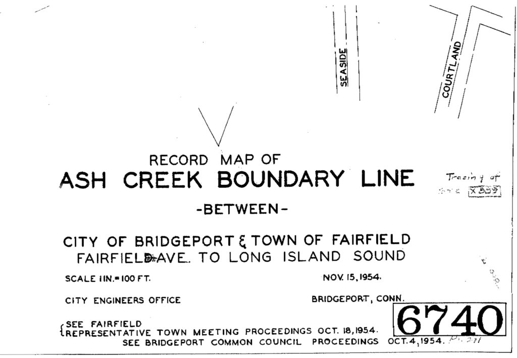
One unexpected finding from the ecological study of Ash Creek, was that the St. Mary’s sand spit may actually not be located entirely within Bridgeport. In order to find out, we went to the City of Bridgeport Engineering office and obtained a Record Map of the Ash Creek Boundary Line between the City of Bridgeport and the Town of Fairfield from Fairfield Avenue to Long Island Sound published November 15, 1954. The map refers to Fairfield Representative Town Meeting Proceedings on October 18, 1954 and Bridgeport Common Council Proceedings on October 4, 1954. We obtained a copy of the Bridgeport Common Council Proceedings which contains the discussion of the boundaries. The land was surveyed by a joint team of both municipalities to define the boundaries.
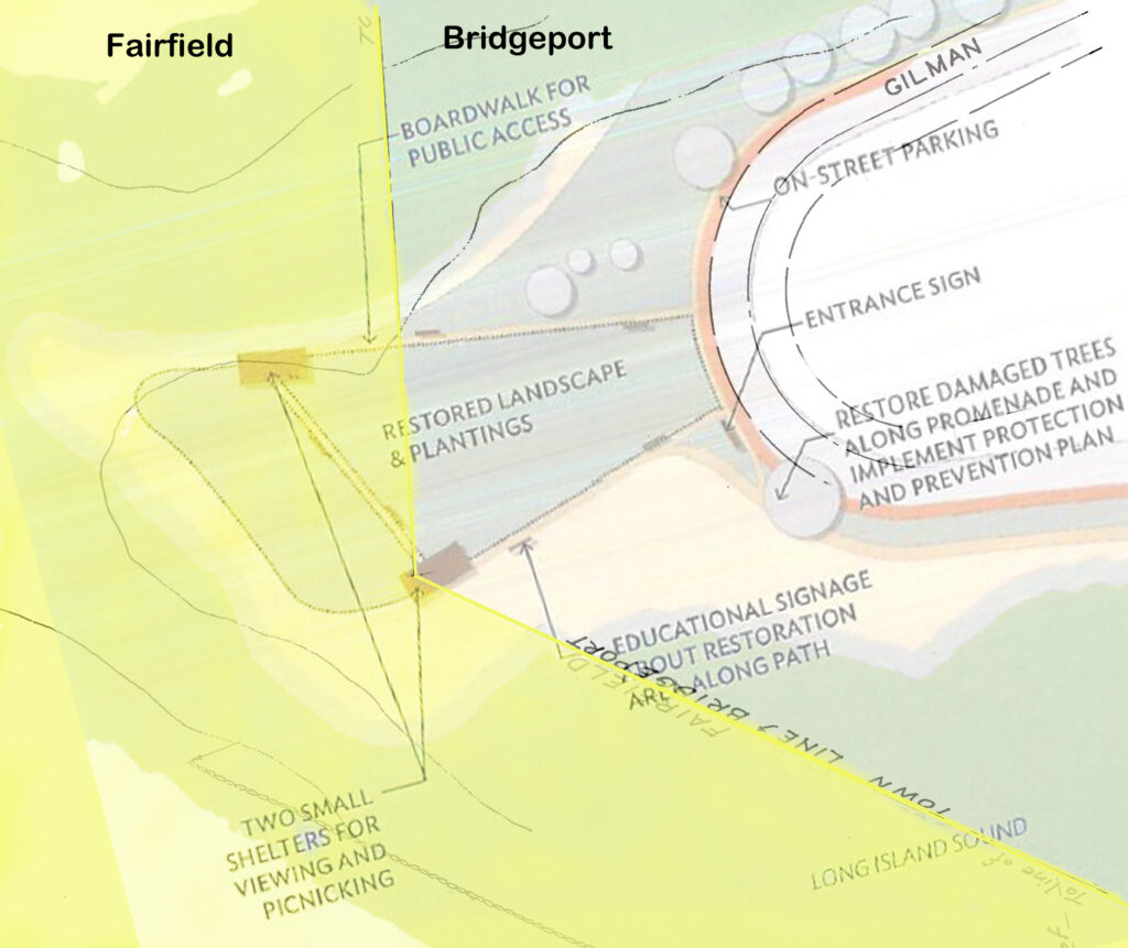
Ultimately, the land is split between Fairfield and Bridgeport, but not in a direct line as you would expect (the white area not just the blue is part of the sand spit). We have superimposed the City of Bridgeport Parks Master Plan development plan for the spit on top of the map. The sand spit has changed shape and form since the survey was done, so the boundary line we’ve superimposed may not be accurate, but it gives a rough idea of how much of the spit may be within each municipality’s boundaries. It’s something that should be taken into consideration in terms of any plans for development or restoration of the barrier spit.
Another factor to be taken into consideration is that the State of Connecticut also has jurisdiction of any land between a five foot elevation above sea level and the water in Bridgeport (as of October 1, 2012 new legislation replaces the statutory definition of a water-based “high tide line” with a land based “coastal jurisdiction line” (CJL). It is not clear how much of the sand spit is below the five foot mark, but we did lose about 2-3 feet of elevation due to Hurricane Sandy, so whether Fairfield or Bridgeport decides to build on the sand spit they will first need to prove to the State DEEP via a survey that the area is above the five foot elevation line.
This provides one more reason for the City of Bridgeport and the Town of Fairfield to work together in jointly managing the Ash Creek tidal estuary. Our efforts to act as a liason between the municipalities is no substitute for a jointly organized municipal entity that has ongoing communication and decision-making capabilities. We will continue to try to be the catalyst for a joint municipal conservation entity for Ash Creek.
The City of Bridgeport plan for development of the St. Mary’s barrier sand spit is shown below:

The plan was obtained from the 2011 Parks Master Plan document found on the City of Bridgeport website on August 2012. See earlier post on this issue to download the Parks Master plan document.
The section of the boundary map showing the the St. Mary’s barrier sand spit is shown below:

The information on the boundaries is from this map:


