

ASSESSMENT OF STORM DAMAGE TO ST. MARY’S SAND SPIT, ASH CREEK
The Ash Creek Conservation Association asked Steven Danzer, Ph.D., who has his doctorate in Natural Resources and is also a Soil Scientist (listed by the Society of Soil Scientists of Southern New England) as well as Professional Wetland Scientist (PWS #1321), Certified Professional in Erosion and Sediment Control (CPESC), and Arborist, CT DEP License S-5639 to assess the storm damage to the St. Mary’s Sand Spit at Ash Creek as a result of Tropical Storm Irene which occurred the week before on 8/27/11-8/28/11.
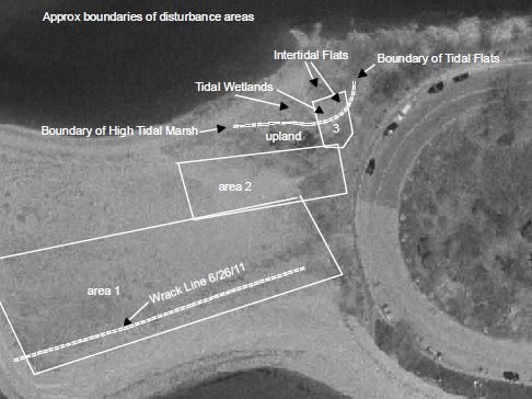
Steve visited the St. Mary’s Sand Spit located near the end of Ash Creek, Bridgeport and Fairfield, CT during low tide on 9/5/11. He had previously visited the site on 6/26/11 shortly after the City of Bridgeport had damaged the site with their earth moving equipment. During that visit he had estimated the aerial extent of the damage by the machinery. At that time he had determined that there were three disturbance areas, which are itemized below and shown in the following diagram:
1) A 306 ft x 45 ft rectangular area beach front area (comprising of roughly 1/2 the original planting zone of the previous restoration effort) had been wiped clean of plantings and re-graded flat, with intrusion evident 10-15 feet seaward below the wrackline. In certain areas you could see where the intruding heavy machinery scraped the beach down to the original cobbly substrate that was there before the restoration efforts.
2) A 90 ft x 40 ft area in the other half of the planted area used for staging, vehicle turn around, and some filling. Half of this area was denuded, the rest just disturbed.
3) A fill pile 26 ft x 51 ft in or adjacent to high salt marsh and tidal flats. Part of the pile was also located on the upland hill slope.
BEFORE – AERIAL PHOTO (2011) AFTER BEACH GRASS PLANTINGS

POST-CITY DISTURBANCE OVERLAY DIAGRAM BY STEVE DANZER
to the areas that were disturbed back in June as compared to the areas that had not been disturbed back in June.
To quote from Steve’s report, “The areas that were previously disturbed back in June were either devoid of vegetation, or the remaining vegetation was at a density so light as to be insufficient to be able to provide ecological or physical function to the landscape at this time. There is now a lack of fine sand material in this area. Total area that was heavily impacted due to the storm was approximately 15,228 sf. (This did not include previous area #3, as it appeared that some or all of the fill pile previously deposited by the City of Bridgeport had been removed since my previous June site visit, making comparison and quantification of storm damage in areas 3 difficult. It did appear though that there had been hydrologic connection between both sides of the spit through this area during the storm, making area #3 now more susceptible to erosion in the future).
In contrast, the areas that were not disturbed back in June only appeared to exhibit mild to moderate storm damage, and remaining plant density was at a level sufficient to continue to provide ecological and physical function to the landscape.
It was evident to me by the pattern of disturbance that vegetated dunes do provide stability to the landscape during high magnitude storm events such as the recent tropical depression. Had the areas not been intensively disturbed back in June by the machinery, I would expect to see less storm event disturbance both to that immediate area, and to the adjacent areas of remaining vegetated dunes which were spared during the June disturbances.”
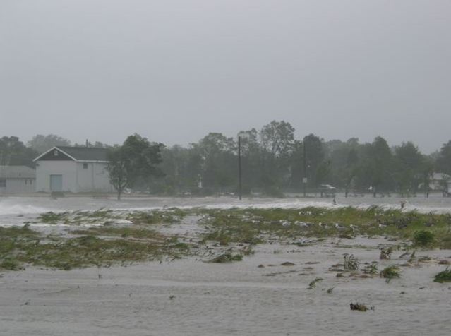
PHOTOS DURING THE STORM
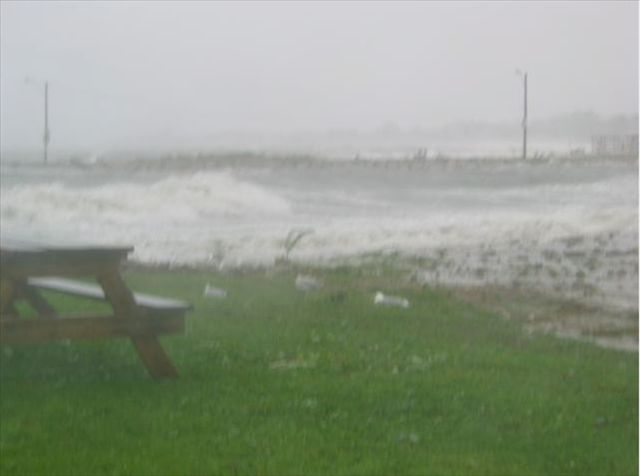
You can see from the photo that there was strong wave action against the Sound facing shore of the sand spit.
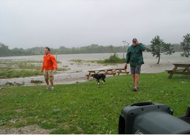
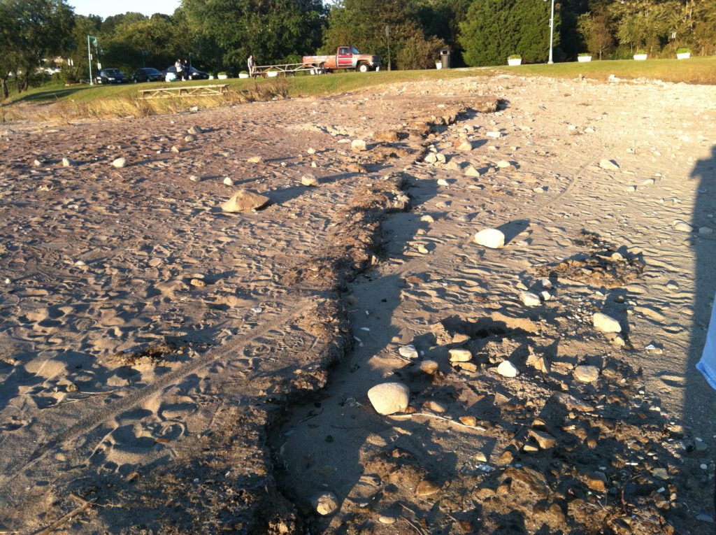
A temporary channel formed at the low point, behind the picnic table, what Steve calls a hydrologic connection. This is one form of erosion.
This is a clearer picture of the hydrologic connection. You can see the water rushing down the temporary channel at the front of the photo.

Another photo of the flow of water down the temporary channel, which could be made deeper by future storms, eventually cutting the sand spit off from the mainland.

The Slosh Map showed that we should expect a storm surge to cross over the entire sand spit in a Category 1 or higher storm and, of course, it did, even though the storm was downgraded from Category 1 to a tropical storm as it arrived along the Connecticut coastline.
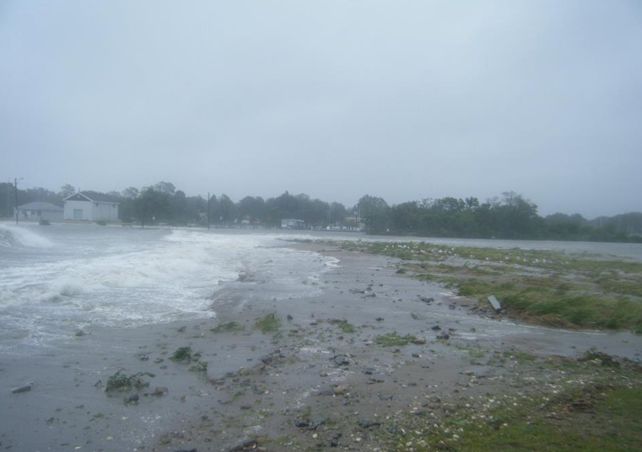
The photo above shows the storm breaching the highest point of the upland area of the sand spit.
POST-STORM PHOTOS

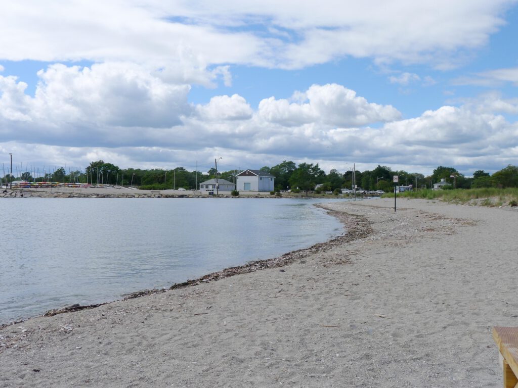
Pre-storm pre-dredging photo from September 2010 (shown above for comparison)

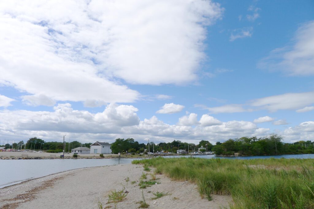
Erosion after the storm. Photo taken August 31, 2011.
Another view of erosion.
BEACH GRASS REMOVAL
Summer 2011 showing beach grass plantings before their removal by the City of Bridgeport

SUMMARY
ACCA asked an environmental scientist, Steven Danzer, Ph.D. to assess the damage from Tropical Storm Irene and to determine the impact of the removal of vegetation by the City on the resulting erosion that occurred. Dr. Danzer found evidence of much more erosion than would have been expected had the vegetation and dunes not been scraped off by the City. (See attached report.)
